During autumn 2016 the S-Cape Travel Agency together with the Association for the Promotion of Tourism Adapted of Asturian Association for the Promotion of Adapted Tourism (APTAA) carried out two field visits in order to travel and evaluate the degree of accessibility of several branches of the French Camino de Santiago Francés; both with regard to accessibility of the route and accommodations located along these legs.
OUR TECHNICAL TEAM
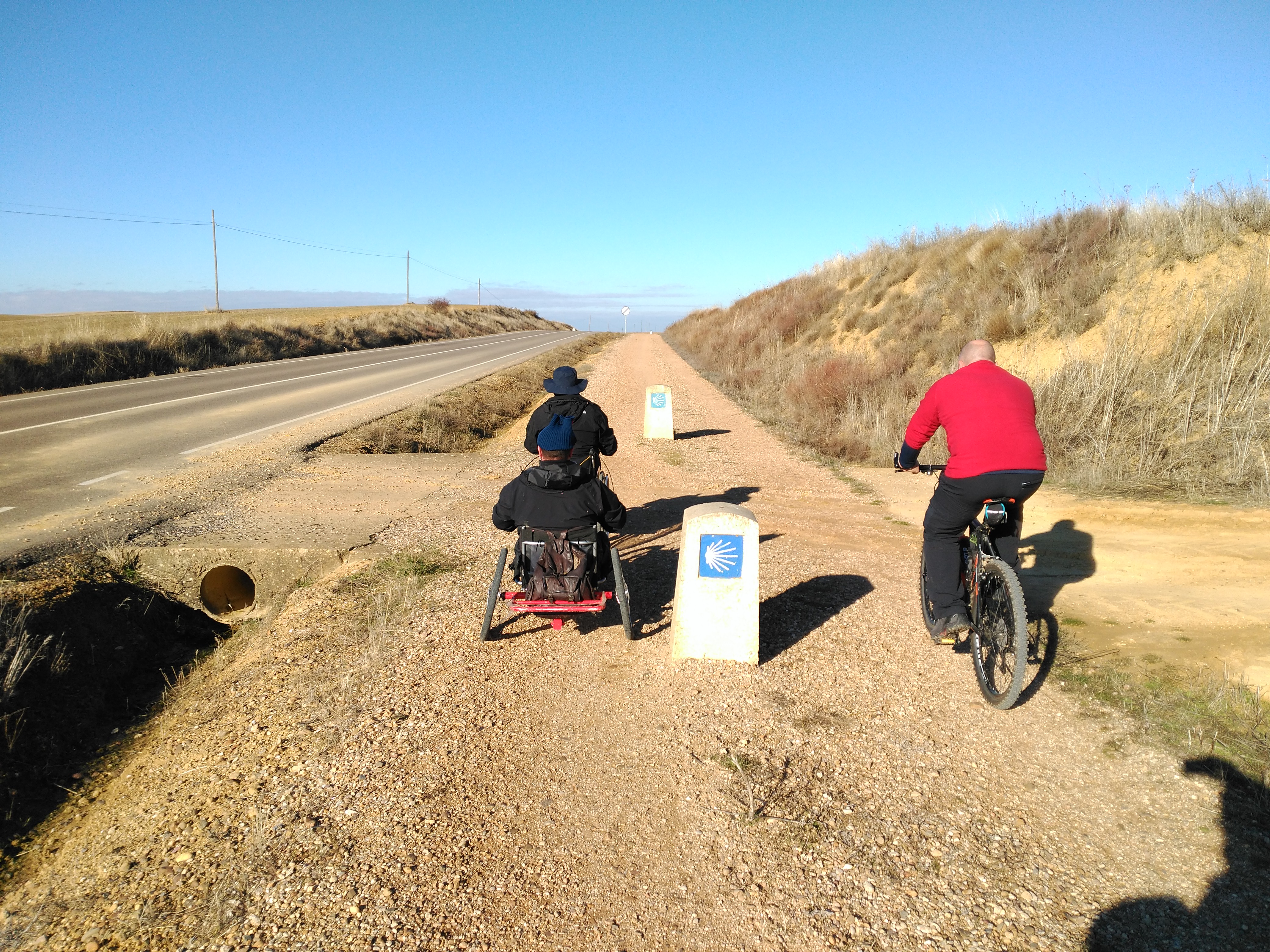
The field work involved the participation of 2 technicians of S-cape agency specialized in design of tourist packages for trekking and biking, 2 technicians of APTAA (Asturian Association for the Promotion of Adapted Tourism) and 2 volunteers who collaborate with this organization. In order to travel the corresponding stages, they used 2 bicycles, 1 manual hand bike, 1electrically powered wheelchair and a minivan.
LEGS EVALUATION
When pre-selecting leg sections to be travelled and excluding those which a priori are NON-ACCESSIBLE, the following studies and already existing sources of information were used:
- Guide of the Camino de Santiago Accessible for all person. PREDIF
- Guide of the Camino de Santiago for persons with incapacities. Ibermutuamur
- Guida al Cammino di Santiago Per Tutti. Autores: Pietro Scirulo y Luciano Callegari (FreeWheels).
- Plan of Touristic Accessibility of the Camino de Santiago. Annex D. Guide Reports (camino, hostels and touristic points of interest)
- GPS-Tracks in .gpx format for travelling on foot and on bicycle on the French Camino de Santiago of the S-Cape Travel agency
- Stages travelled previously with APTAA on field trips carried out by the Associations with groups of persons with impairment.
As a result of this in-house analysis, the following leg sections classified as SUITABLE or ACCESSIBLE were selected and travelled:
|
LEGS TRAVELLED IN WHEELCHAIRS, HAND BIKE AND BICYCLE |
||
| GALICIA | CASTILE AND LEÓN | |
|
|
|
| TOTAL: 42,5 Km | TOTAL: 100 km | |
The following issues about the route were evaluated: type of road surface, trail width inclination, slope and possible obstacles.
EVALUATION OF ACCOMMODATIONS
Before starting the field trip, an in-house study consisting in the pre-selection of accommodations (hotels, hostels, boarding houses) which a priori have accessible installations was carried out. The pre-selection was made based on:
- Guía de Alojamientos Accesibles de Galicia. Edit: Xunta de Galicia, Textos: PREDIF. 2010
- Guida al Cammino di Santiago Per Tutti. Authors: Pietro Scirulo and Luciano Callegari (FreeWheels). Edit: Terra di Mezzo
- Booking www.booking.com. Ticking “Facilities for disabled guests” in the “Facility” menu, you can search for accommodations with ‘accessible installations’ and/or ‘lift’.
A total of 163 establishment were identified as accessible; 55 were visited in situ checking the actual accessibility of adapted rooms and bathrooms as well as other aspects of their installations (access, parking spaces, lift, furniture, dining room and other common installations, additional services, etc…).